
Itineraries
Itinerary I – Bylis Antiquity
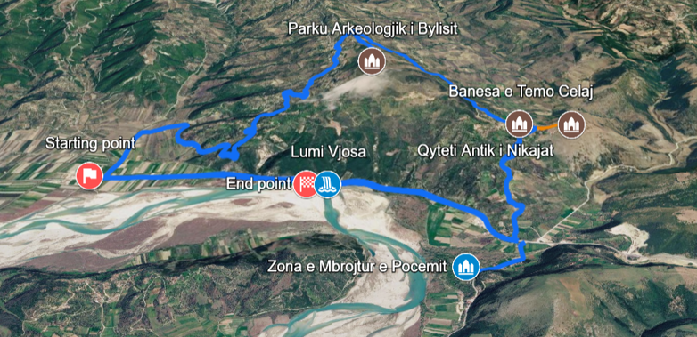
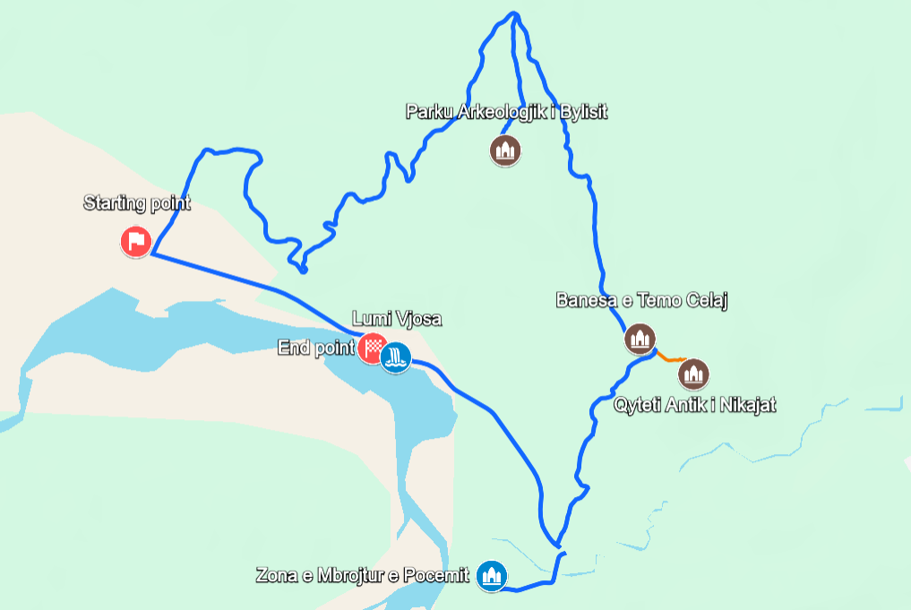
A circular route from Poçem to Bylis, Klos and Nikaia, by car, bike or on foot
- Difficulty (1–10)
- Moderate
- Distance
- 15.7 km
- Duration
- Full day (5–7 hrs)
- Elevation
- 31–396 m
Circular route starting and ending at the Poçem crossroad. Easy by car, moderate by bike or on foot. The Hekal–Klos segment reaches 479 m.
The Bylis Antiquity itinerary is a moderate, full-day cultural and natural route of about 15.7 kilometres. It forms a circular loop from the crossroad of Poçem, passing through Hekal, Klos and the ancient site of Nikaia in Mallakastër, southern Albania.
The route climbs from 31 metres at the start to a maximum of 479 metres near Klos. It follows asphalt and gravel roads, then turns into a short but steep walking trail to the hilltop ruins of Nikaia.
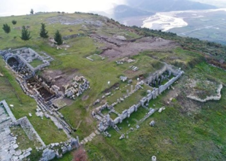
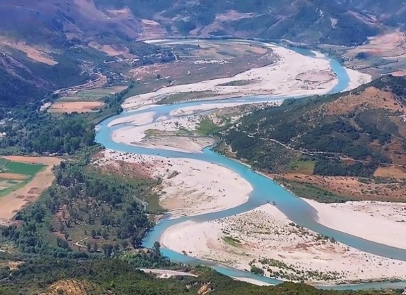
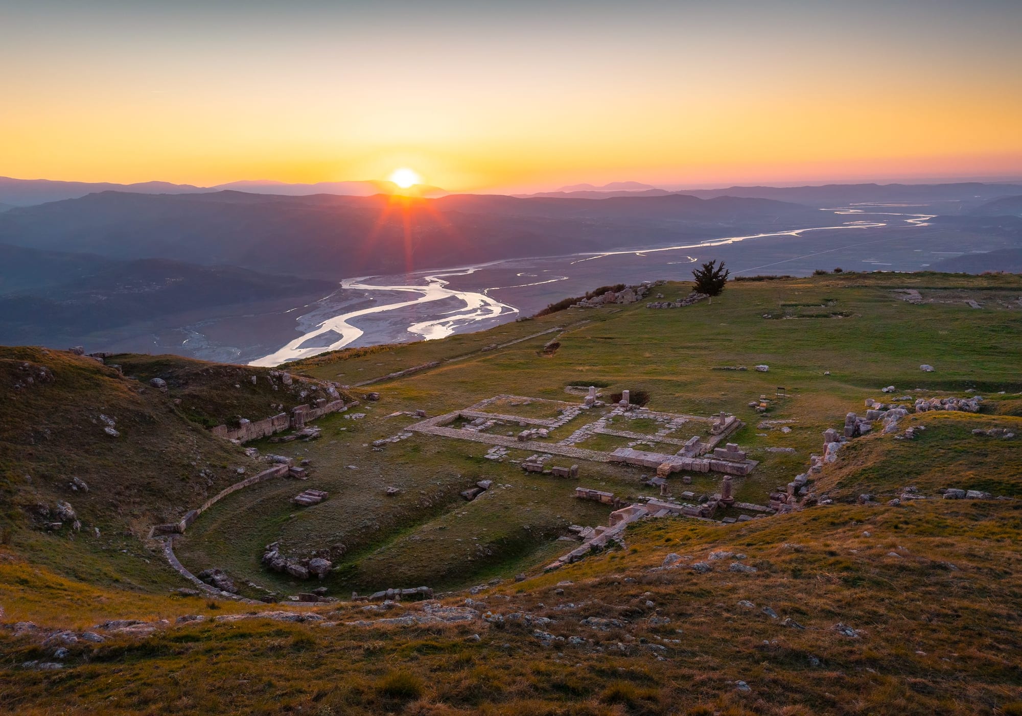
Along the way, visitors encounter five points of interest that span nature, history and archaeology: the protected landscape of Poçem, the wild Vjosa River, the Illyrian city of Bylis, the historic Temo Celaj House in Klos and the ancient city of Nikaia. The route is at its best in spring and autumn, and rewards travellers with panoramic views over the Vjosa Valley and a strong sense of Albania’s Illyrian past.
The route, step by step
- Start — national road, crossroad to Hekal
- Hekal — Bylis Archaeological Park
- Klos village centre — Temo Celaj House
- Old Klos — Ancient City of Nikaia
- Poçem — Poçem Protected Area
- Vjosa River — a short walk to the riverbank
- End — back at the Poçem crossroad
The first 4 km from Poçem are relatively flat. From kilometre 4 the road climbs steadily, reaching about 300 m at kilometre 7.8 and a maximum of 396 m, before descending back to Poçem. The Hekal–Klos segment (1.9 km) climbs from 394 m to 479 m. The walking path to Nikaia is only 217 m long but steep, with slopes of up to 19.8°.
Difficulty by segment
| Segment | Difficulty | Notes |
|---|---|---|
| Poçem → Hekal, about 5 km | Easy–moderate | Gradual climb from 31 m to 394 m on a winding road |
| Hekal → Klos, 1.9 km | Moderate | Steady climb to 479 m, slopes up to 9.1° |
| Klos → Nikaia, 217 m on foot | Moderate–challenging | Steep walking trail, slopes up to 19.8° |
| Klos → Poçem, about 7 km | Moderate | Descent with some undulations, slopes up to 10.2° |
| Poçem → Vjosa River, 0.2 km | Easy | Flat, short walk to the riverbank |
Time and difficulty by transport
| Mode | Time | Difficulty | Notes |
|---|---|---|---|
| Car | 1.5–2.5 hrs | Easy–moderate | Driving plus short walks; the final approach to Nikaia is on foot |
| Mountain bike | 2–3.5 hrs | Moderate | Significant climbing; gravel sections need an MTB |
| On foot, full route | 5–7 hrs | Moderate–challenging | About 448 m of elevation gain |
| Car and walking | 3–5 hrs | Easy–moderate | Drive to key points, walk to each site — recommended |
A full day by car and on foot fits comfortably between 9:00 and 17:00.
Practical tips
- Best season: spring (April–June) and autumn (September–October), with mild temperatures and green landscapes
- What to bring: hiking shoes, at least 2 litres of water, sun protection, a hat, snacks and a camera
- Road conditions: asphalt and gravel roads; an unpaved walking trail to Nikaia
- Where to stay: Agroturizem Bylis
Strengths
Cultural heritage
- Bylis Archaeological Park, one of the largest Illyrian cities, with five early Christian basilicas
- The ancient hilltop city of Nikaia, with its rock-cut theatre and fortification walls
- The historic Temo Celaj House in the village of Klos
Nature and landscape
- The Vjosa River, a National Park since 2023 and a UNESCO Biosphere Reserve since 2025
- The protected landscape of Poçem
- Oak and hornbeam woodlands and panoramic views over the Vjosa Valley
Practical
- Asphalt and gravel roads throughout; an unpaved walking trail to Nikaia
- Can be done by car, mountain bike or on foot
- Accommodation nearby at Agroturizem Bylis
1 / 27
-
Bylis Archaeological Park
The expansive Illyrian city of Bylis above the village of Hekal, with its five basilicas. Recently declared a National Immovable Asset.
Read more → -
Ancient City of Nikaia
A hilltop city above old Klos with a rock-cut theatre and fortification walls, reached by a short, steep walking trail.
Read more → -
Vjosa River
One of Europe's last wild rivers, a National Park and UNESCO Biosphere Reserve, a short walk from the end of the route.
Read more →